Beyond the Sidewalk: Urban Planning Strategies for Child Pedestrian Safety
Explore how urban planning and design create safer environments for children walking and cycling. Discover key strategies for protecting young pedestrians.
Beyond the Sidewalk: Urban Planning Strategies for Child Pedestrian Safety
“Explore how urban planning and design create safer environments for children walking and cycling. Discover key strategies for protecting young pedestrians.”
Ensuring children can move safely and independently through their communities is fundamental to their development, health, and wellbeing. However, the design of many urban environments often prioritises vehicular traffic over the needs of pedestrians, especially children. This creates significant risks and limits children’s freedom to explore. Effective urban planning child pedestrian safety strategies are crucial for creating environments where children can walk, cycle, and play without constant fear for their safety, fostering healthier, more active lifestyles from an early age.
Understanding the Challenge: Why Children are Vulnerable Pedestrians
Children, by their very nature, are more vulnerable in traffic environments than adults. Their physical, cognitive, and perceptual development means they interact with roads and vehicles differently, often with less awareness of potential dangers. Recognising these vulnerabilities is the first step towards designing safer urban spaces.
Developmental Factors: How Children Perceive Risk
Children’s understanding of traffic and risk evolves significantly with age:
- Under 5s: These young children have limited peripheral vision, struggle to judge speed and distance, and often act impulsively. They rely heavily on adult supervision and physical barriers for safety. Their short stature also makes them less visible to drivers.
- 5-9-year-olds: While their awareness improves, children in this age group may still have difficulty localising sounds, assessing traffic gaps, and understanding complex traffic situations. They are often distracted by play or friends, making them less attentive to their surroundings.
- 10-12-year-olds: Older children develop better judgment and perception skills but can still overestimate their abilities or be influenced by peer pressure, leading to risky behaviours. They may also be navigating more complex routes independently.
A 2022 report by the World Health Organisation (WHO) highlights that road traffic injuries remain a leading cause of death for children and young adults aged 5-29 years globally, with pedestrians and cyclists accounting for a significant proportion of these fatalities. This underscores the urgent need for urban design that accounts for these developmental stages.
Statistical Realities: Global Injury Data
The statistics paint a stark picture of the dangers children face as pedestrians. According to UNICEF, approximately 1.2 million children and adolescents die annually from preventable injuries, with road traffic injuries being a major contributor. In many low- and middle-income countries, children walking or cycling are disproportionately affected. Even in high-income countries, pedestrian fatalities involving children persist, particularly in areas with high traffic volumes and inadequate infrastructure. For instance, data from the European Transport Safety Council (ETSC) indicates that despite overall reductions in road deaths, child pedestrian fatalities remain a concern, often linked to urban design flaws.
Key Takeaway: Children’s developmental limitations, including restricted vision, poor judgment of speed, and impulsivity, make them inherently more vulnerable in traffic. Global statistics confirm road traffic injuries are a leading cause of death and disability for children, demanding proactive urban planning interventions.
Core Principles of Child-Friendly Urban Design
Creating truly child-friendly urban spaces goes beyond isolated interventions; it requires a holistic approach embedded in the very fabric of urban planning. These principles guide the transformation of cities into environments that nurture children’s independence and safety.
Prioritising Pedestrians and Cyclists: Shifting the Paradigm
Traditionally, urban planning has often prioritised the efficient movement of motor vehicles. A fundamental shift is needed to place pedestrians and cyclists, especially children, at the top of the transport hierarchy. This means designing streets and public spaces primarily for people, with vehicles as secondary users.
- Reduced Speed Limits: Implementing 20 mph (30 km/h) zones in residential areas, around schools, and in city centres dramatically reduces the severity of collisions. A pedestrian hit by a vehicle at 20 mph has a significantly higher chance of survival compared to one hit at 30 mph.
- Car-Free Zones: Designating specific areas, such as town squares or streets adjacent to parks and schools, as car-free or restricted-access zones provides safe havens for children to play and move freely.
- Integrated Networks: Developing comprehensive networks of interconnected footpaths and cycleways that are separate from main roadways, offering safe alternatives to driving for short journeys.
Proximity and Accessibility: The 15-Minute City Concept for Kids
The “15-minute city” concept, where most daily necessities and services are accessible within a 15-minute walk or cycle from home, is particularly beneficial for children. It reduces the need for car travel, promotes active mobility, and increases children’s independence.
- Mixed-Use Development: Planning residential areas alongside shops, schools, healthcare facilities, and recreational spaces reduces travel distances. This encourages families to walk or cycle, making these activities a natural part of daily life.
- Localised Amenities: Ensuring a sufficient distribution of playgrounds, green spaces, and community centres throughout neighbourhoods, so children do not have to cross major roads to reach them.
- Accessible Public Transport: Where longer journeys are necessary, public transport should be easily accessible, safe, and designed with children in mind, including well-lit stops and clear information.
Implementing Safe Routes to School Design
The journey to and from school is a critical period for child pedestrian safety. Designing “Safe Routes to School” (SRTS) programmes involves a combination of infrastructure improvements, education, and enforcement to make these daily trips secure and enjoyable.
Network Planning: Connected Pathways
Effective SRTS initiatives focus on creating a seamless network of safe pathways that connect homes to schools, crossing points, and other community destinations.
- Mapping Current Routes: Identify existing pedestrian and cycling routes, pinpointing hazards such as busy intersections, lack of pavements, or poor lighting. This often involves community “walkability audits.”
- Identifying Desire Lines: Observe where children naturally want to walk or cycle, even if no formal path exists, to inform new infrastructure placement.
- Creating Dedicated Paths: Constructing segregated footpaths and cycle lanes where space permits, or clearly marked shared-use paths in lower-traffic areas. These should be wide enough for multiple users and well-maintained.
- Minimising Road Crossings: Designing routes that reduce the number of times children must cross roads, especially busy ones. Where crossings are unavoidable, they should be highly visible and protected.
Infrastructure Solutions: Pavements, Crossings, Lighting
High-quality infrastructure is the backbone of any safe pedestrian network.
- Continuous, Wide Pavements: Ensuring pavements are consistently available, well-maintained, and wide enough for children to walk side-by-side or for adults with prams. They should be free from obstructions like street furniture or poorly placed bins.
- Safe Crossing Points:
- Raised Pedestrian Crossings: These act as speed humps, forcing vehicles to slow down, and elevate pedestrians to be more visible.
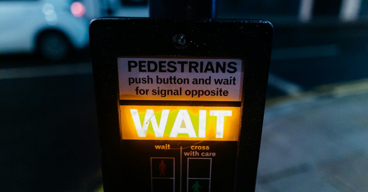
- Signalised Crossings (Pelican/Puffin Crossings): Provide clear signals for pedestrians and vehicles, with adequate time for children to cross. Some include audible signals for visually impaired users.
- Zebra Crossings: Highly visible crossings where pedestrians have priority, often supplemented with flashing beacons.
- Crossing Guards: Employing trained crossing guards at key intersections during school peak times provides an additional layer of human supervision and safety.
- Adequate Lighting: Well-lit routes deter crime and improve visibility for both pedestrians and drivers, especially during darker months or early mornings. Smart lighting systems can adjust intensity based on presence.
- Clear Signage and Markings: Intuitive wayfinding signs, clear road markings, and warning signs for drivers indicating school zones or child-heavy areas are essential.
Community Engagement: Involving Parents and Children
Successful SRTS programmes are not just about infrastructure; they actively involve the community.
- Participatory Design Workshops: Engage children, parents, and teachers in the design process. Children can offer unique insights into their daily journeys and perceived dangers.
- “Walking School Buses” and “Cycle Trains”: Organised groups of children who walk or cycle to school together, supervised by adults. These initiatives increase safety in numbers and encourage active travel.
- Parent-Teacher Associations: Collaborate with PTAs to advocate for safety improvements and organise educational campaigns.
- Local Authorities and Police: Work with local councils and police to enforce speed limits and address specific safety concerns identified by the community.
Traffic Calming for Kids: Reducing Vehicle Speed and Volume
Traffic calming measures are physical design elements and policy changes implemented to slow down vehicle speeds and reduce traffic volume, making streets safer and more pleasant for all users, particularly children.
Physical Measures: Speed Humps, Chicanes, Raised Crossings
These interventions physically alter the road environment to force drivers to reduce speed.
- Speed Humps/Cushions: Raised areas across the width of the road or smaller “cushions” that can be straddled by larger vehicles but not by cars, forcing them to slow down. They are particularly effective near schools and playgrounds.
- Chicanes and Lateral Shifts: These introduce curves or shifts in the road alignment, requiring drivers to steer around them, thereby reducing speed. They can also narrow the perceived road width.
- Raised Junctions/Intersections: Elevating entire junctions to pavement level creates a continuous surface for pedestrians and cyclists, signalling to drivers that they are entering a shared space and must yield.
- Pavement Extensions (Build-outs/Kerb Extensions): Widening pavements at intersections reduces the crossing distance for pedestrians and improves their visibility to turning vehicles.
Design Interventions: Narrowed Streets, Shared Spaces
Beyond direct physical obstacles, design principles can influence driver behaviour and create a more pedestrian-friendly atmosphere.
- Narrowed Carriageways: Reducing the width of vehicle lanes can subconsciously encourage drivers to slow down. This space can then be reallocated to wider pavements, cycle lanes, or green verges.
- Shared Space Concepts: In low-speed, low-volume areas, particularly town centres or residential cul-de-sacs, the traditional separation between vehicles and pedestrians can be blurred. Without distinct kerbs or road markings, drivers are encouraged to proceed with caution and negotiate with other users. This approach requires clear communication and driver awareness.
- Street Furniture and Planting: Strategically placed benches, planters, trees, and public art can create visual friction, making streets feel less like high-speed corridors and more like community spaces. This also provides natural barriers between pedestrians and traffic.
Policy and Enforcement: Speed Limits, Enforcement
Effective traffic calming also relies on robust policy and consistent enforcement.
- Mandatory Speed Limits: Implementing and clearly signposting lower speed limits (e.g., 20 mph or 30 km/h) in residential areas, school zones, and high-pedestrian areas.
- Automated Enforcement: Speed cameras and average speed cameras can deter speeding more consistently than manual enforcement.
- Community Watch Programmes: Empowering local residents to report speeding or dangerous driving, working in conjunction with local authorities and police.
- “Stop and Go” Programmes: In some areas, temporary road closures or restrictions during school drop-off and pick-up times can create entirely car-free zones, offering maximum safety for children.
Beyond Infrastructure: Holistic Approaches to Urban Planning for Child Safety
While physical infrastructure is paramount, a truly comprehensive approach to urban planning child pedestrian safety extends to integrating green spaces, leveraging technology, and fostering educational programmes. These elements combine to create a resilient and supportive environment for children.
Green Spaces and Play Areas: Integrating Nature
Integrating green spaces and natural elements into urban design offers multiple benefits for child safety and wellbeing.
- Safe Play Environments: Providing dedicated, car-free play areas within neighbourhoods allows children to play freely without direct exposure to traffic. These spaces should be easily accessible, visible, and well-maintained.
- Natural Barriers: Strategic planting of trees, hedges, and shrubs can create natural buffers between pavements and roads, offering both a physical barrier and a psychological sense of safety.
- Improved Air Quality: Green infrastructure, such as street trees and urban parks, helps to filter air pollutants, contributing to children’s respiratory health, especially near busy roads.
- Opportunities for Active Travel: Parks and greenways can serve as safe, attractive routes for walking and cycling, encouraging physical activity. [INTERNAL: The Importance of Outdoor Play for Child Development]
Digital Tools for Planning and Monitoring: GIS, Community Apps
Modern technology offers powerful tools for urban planners and communities to assess, plan, and monitor pedestrian safety.
- Geographic Information Systems (GIS): GIS mapping allows planners to visualise accident hotspots, analyse traffic flow data, identify areas lacking safe infrastructure, and simulate the impact of proposed changes. This data-driven approach helps target interventions effectively.
- Community Reporting Apps: Mobile applications can empower residents, including parents, to report hazards, poor lighting, speeding vehicles, or infrastructure defects directly to local authorities. This real-time feedback loop helps councils respond quickly to emerging issues.
- Pedestrian Modelling Software: Advanced software can simulate pedestrian movement patterns, identify congestion points, and assess the effectiveness of new crossings or pathways before construction, optimising design for safety and flow.
Education and Awareness Programmes: Complementing Design
Even the best urban design needs to be complemented by ongoing education and awareness initiatives to foster a culture of safety.
- Road Safety Education in Schools: Incorporating age-appropriate road safety lessons into the school curriculum, teaching children about pedestrian rules, traffic signs, and safe crossing techniques. For younger children (aged 5-7), this might involve practical pavement skills, while older children (8-12) can learn about cycling safety and planning safe routes.
- Public Awareness Campaigns: Local authorities can run campaigns targeting drivers, emphasising the importance of speed reduction in residential areas and vigilance around schools. Campaigns can also educate parents on supervising young children and teaching older children safe independent travel skills.
- “Walk to School Week” Initiatives: Organising events that encourage walking or cycling to school, often with incentives or challenges, helps to embed active travel habits and highlight the need for safe routes.
What to Do Next
Creating safer urban environments for child pedestrians requires a collaborative effort from parents, community members, and local authorities. Here are concrete steps you can take:
- Conduct a Local Safety Audit: Walk your child’s usual routes to school, parks, and friends’ houses. Note any hazards such as missing pavements, poor lighting, overgrown vegetation blocking sightlines, or dangerous crossings. Document these with photos and specific locations.
- Engage with Your Local Council: Present your findings from the safety audit to your local council’s planning or transport department. Advocate for specific improvements, referencing relevant strategies like 20 mph zones or raised crossings. Join or form a community group to amplify your voice.
- Participate in School Initiatives: Support “Safe Routes to School” programmes, “Walking School Buses,” or “Cycle Trains” at your child’s school. Volunteer to supervise or help organise events that promote active and safe travel.
- Educate Your Children: Reinforce road safety rules at home. Teach children how to identify safe crossing points, the importance of looking and listening, and how to make themselves visible to drivers. Tailor the advice to their age and developmental stage.
- Be a Responsible Driver: Always drive cautiously, especially in residential areas and around schools. Adhere to speed limits, be vigilant for children, and respect pedestrian crossings. Your driving behaviour sets an example for the community.
Sources and Further Reading
- World Health Organisation (WHO): Road traffic injuries. https://www.who.int/news-room/fact-sheets/detail/road-traffic-injuries
- UNICEF: Children and Road Safety. https://www.unicef.org/transport-and-mobility/road-safety
- European Transport Safety Council (ETSC): Child Safety. https://etsc.eu/category/pin-thematic-reports/child-safety/
- NSPCC: Staying safe outdoors. https://www.nspcc.org.uk/keeping-children-safe/support-for-parents/staying-safe-outdoors/
- Sustrans: Safe Routes to School. https://www.sustrans.org.uk/